Alexander the Great
Alexander the Great
Antique Map of Alexander the Great’s Conquests - 1732
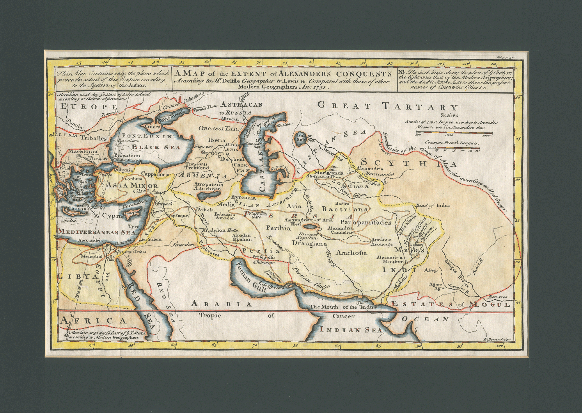
Beautiful engraved hand-colored antique map dated 1732, by the distinguished 18th-century cartographer Emanuel Bowen, depicting the broad and impressive extent of conquests by young Alexander the Great, whose empire—by the time of his death at age 32—comprised a good part of the known world.
About Alexander the Great
Born into Macedonian royalty in 356 B.C.E., Alexander was tutored by the philosopher Aristotle until he was 16. Succeeding his assassinated father to the throne in 336, Alexander inherited a strong kingdom and a highly accomplished army. Following in the path of his father’s military expansion plans, in 334 Alexander invaded the Achaemenid Empire, ruled Asia Minor, and began a series of campaigns that lasted ten years. In a series of decisive battles he subsequently conquered the entire Persian Empire, at which point his own empire now stretched from the Adriatic Sea to the Indus River, as depicted on the far right edge of this historical map.
Though his military conquests were significant in themselves, Alexander’s legacy extended well beyond battle. His campaigns resulted in substantial trade between East and West, and vast areas east of Macedonia were heavily exposed to Greek civilization and influence. Many of the cities he founded became major cultural centers, some surviving into the 21st century.
Emanuel Bowen (1694?-1767) was an English map engraver who worked for King George II of England and King Louis XV of France. Working from his London studio at around age 20, Bowen produced some of the most attractive maps of the century, recognized for their high quality and accuracy. A recurring feature of Bowen’s work was his habit of filling every corner and space of the map with jottings and footnotes, both historical and topographical, as can be seen in this map of Alexander’s conquests.
One of his earliest engraved works was Britannia Depicta, published in 1720 and featuring over two hundred road maps together with a miniature county map of England and Wales. It was an unusual feature of the atlas that the maps were engraved on both sides of each page, and this resulted in a handier sized book.