Catherine the Great
Catherine the Great
Russian Cadastral Map - 1785
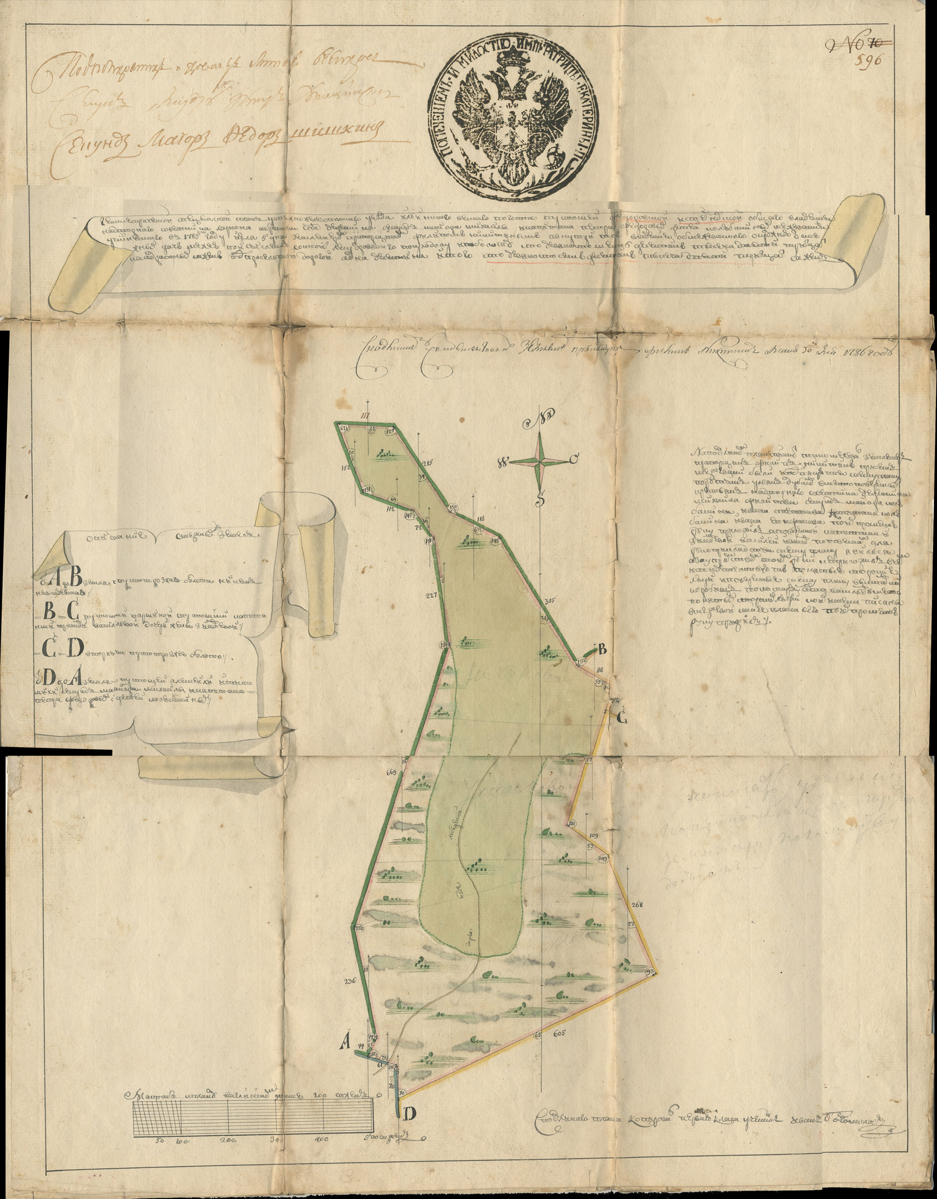
One-of-a-kind, original hand-drawn, hand-colored antique cadastral map of a Russian land survey dated 1785, commissioned by Catherine II, Empress of Russia from 1762-1796. Unsigned by the Empress. A beautiful artifact of Russian history that would look marvelous in a royally framed presentation. Measures 19″ x 25″.
General land surveys of the Russian Empire, carried out in the late 18th- and early 19th-centuries, resulted in the appearance of cadastral maps, which show the boundaries and subdivisions of land. These plats are distinguished by their historical and geographical interest, but they also provided valuable statistical and economic data; most of them record ownership and rights in land. General plans of the principal administrative units of the empire, as well as atlases containing plans of towns and maps of districts, were also produced on the basis of land survey works.
The General Land Survey is one of the key events in the history of Russian cartography. One of the most ambitious projects of Catherine II, it was launched by the manifest of 1765. Its mission was not only to consider the land property rights, but also to create the all-Russia land cadaster, a thorough investigation of the country’s demographic, economic and natural resources, and, last but not least, to provide the imperial administration with a set of high scale maps of the country. This vast territory included over 1.5 million square kilometers and over 70% of the empire’s total population.

Portrait of Catherine II. State Tretyakov Gallery. Not included; reference only.